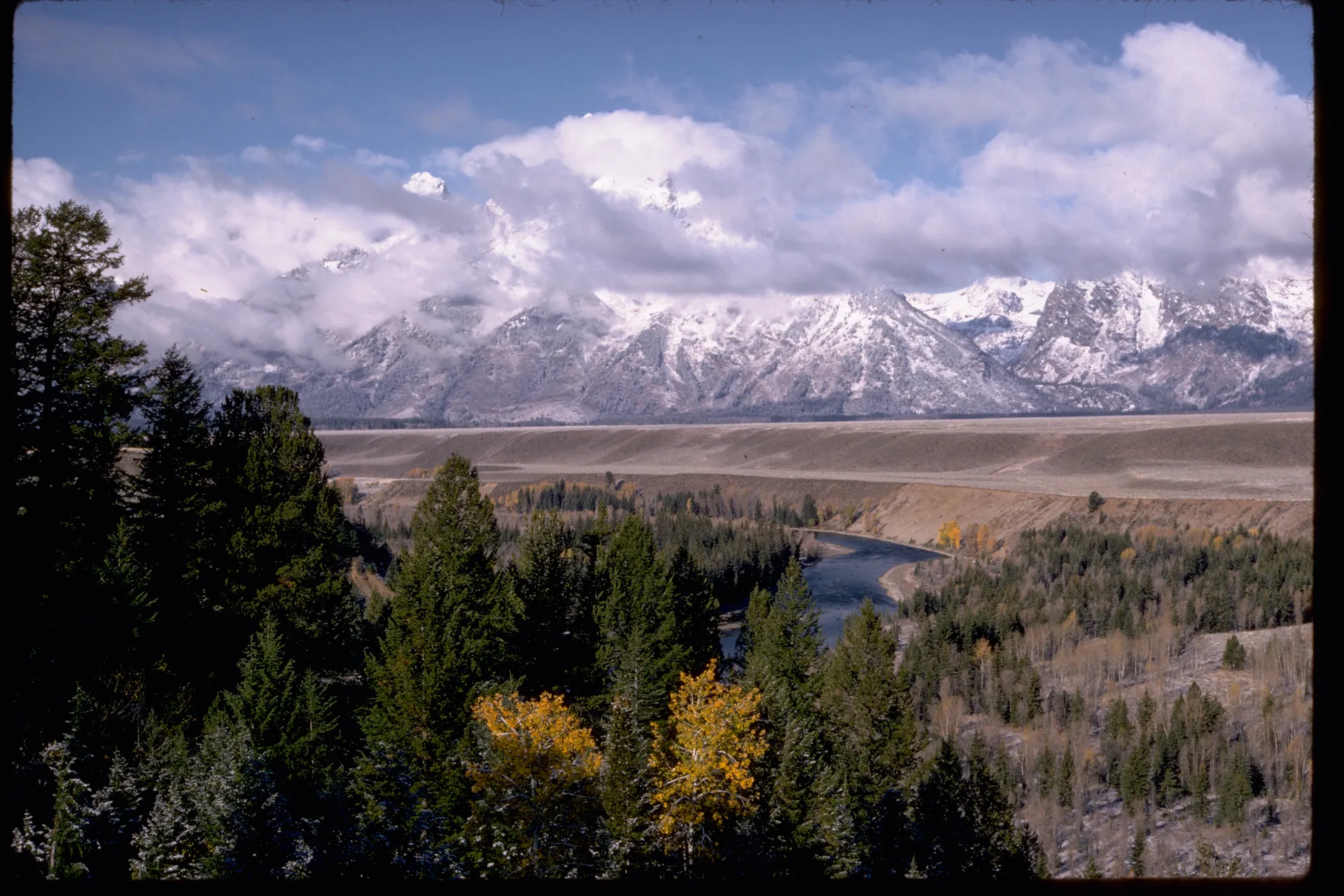
Grand Teton is often introduced as a skyline. That is understandable: the range rises with unusual immediacy from Jackson Hole, and the profile can hold attention before a visitor has learned the name of a river channel or noticed the sagebrush underfoot. Yet the peaks make more sense when the eye begins low. Gravel, water, soil, habitat, forest, moraine, canyon, weather, and human history are not scenery beneath the mountains. They are the field in which the mountains become legible.
This guide follows that field from valley to summit. It is not a route prescription, a current-conditions bulletin, or a promise of access. Roads, trails, weather, fire, smoke, water, wildlife guidance, permits, and operations can change. Use this essay to identify the right questions, then consult the responsible public authority for the day you intend to travel.
1. Begin with the fault, but do not stop there
The Teton Range and Jackson Hole sit across a major structural boundary. Movement along the Teton fault lifted the mountain block relative to the valley, helping create the abrupt eastern front that distinguishes the view. Erosion then worked on the rising rock. Ice occupied high basins and flowed through canyons. Water, frost, gravity, and time loosened and transported material. The valley floor accumulated sediments while the high country retained steep relief.
That relationship corrects two common habits. First, the mountains are not a freestanding backdrop placed behind a flat foreground. Range and valley are connected products of movement. Second, “old mountains” is too simple a phrase. Rock age, uplift, erosion, glaciation, and the present form of a peak operate on different clocks. A useful field note keeps those clocks separate instead of compressing them into one dramatic number.
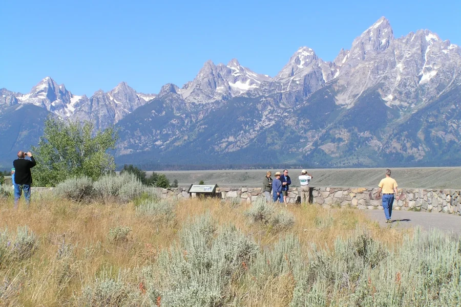
From an overlook, look for the transition from the open valley floor to forested lower slopes, then for canyons cutting westward into the range. Notice how quickly the relief changes. That visual break is more informative than memorizing a summit list. It tells you why distance, weather, elevation, and turnaround time can change so sharply within a day.
2. Read the valley as deposited ground
Jackson Hole is not an empty stage. Its surface records material moved by ice and water: till, outwash, gravels, lake sediments, river deposits, and alluvial fans. Moraines can form ridges and thresholds. Outwash spreads sorted material beyond an ice margin. Streams rework earlier deposits. Wet ground, sage flats, forest patches, and ponds respond to subtle changes in elevation, drainage, soil, and disturbance.
This is why a lower-third view matters. A photograph that includes only sky and peaks removes much of the evidence. In the valley, even a shallow rise may change the vegetation or redirect water. A band of trees may signal moisture, shelter, or a river corridor. A gravel bar shows that a channel has transported more than water. A lake edge may be tied to glacial landforms that continue out of sight.
When choosing a stop, ask what the foreground can explain. Is the surface sagebrush, willow, forest, wetland, cobble, or maintained lawn? Does the view cross a river corridor? Is the ground a safe, legal place to stand, or are you tempted to create an informal path? Reading deposited ground should increase care, not just vocabulary.

Grand Teton National Park Tour from Jackson Hole
Experience the tranquil landscapes of Grand Teton National Park on this easy day trip from Jackson. A must-see Wyomi...

Private Scenic Snake River Float - Grand Teton Nat'l Park
Discover the natural beauty of Grand Teton National Park on a private scenic float trip along the Snake River. This...

Self-Guided Audio Driving Tour in Grand Teton National Park
Download the GuideAlong self-guided audio tour, and you'll discover more on your Catskill Mountains road trip. Frust...
3. Follow water as a braid, not a blue line
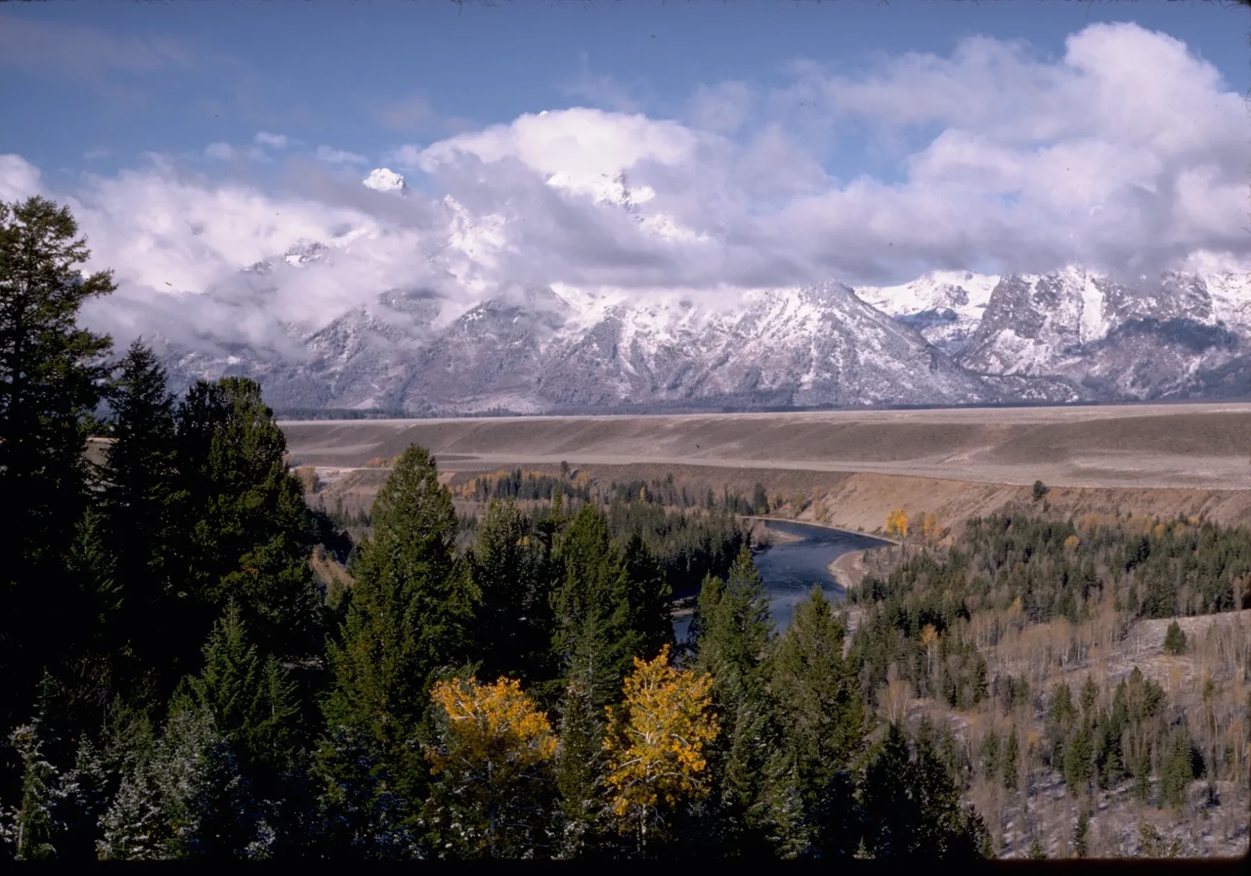
The Snake River is a powerful organizing feature of the valley, but a map’s single blue line can hide its complexity. Channels divide and rejoin. Gravel bars emerge and shift. Side channels, wetlands, oxbows, and riparian vegetation create varied habitat. Seasonal flow, sediment, woody material, ice, and management all affect what a visitor sees.
“Braided” is therefore more than a visual metaphor. It is a reminder that a river occupies space. The active corridor may be wider than the water visible from one bank. A dry-looking bar can still be part of the river’s work. Vegetated islands and side channels can be sensitive habitat. Approaching water safely requires attention to current conditions, cold, current, unstable footing, boat-cleaning requirements, and closures—not a judgment made from a scenic photograph.
At a river overlook, trace more than the main channel. Look for color and texture changes between water, bare gravel, willow, sage, and mature trees. Consider which surfaces are temporary and which are relatively stable. Then let the river change how you understand the range: water and sediment carry the high country outward, grain by grain, into the valley.
4. Let lakes explain thresholds
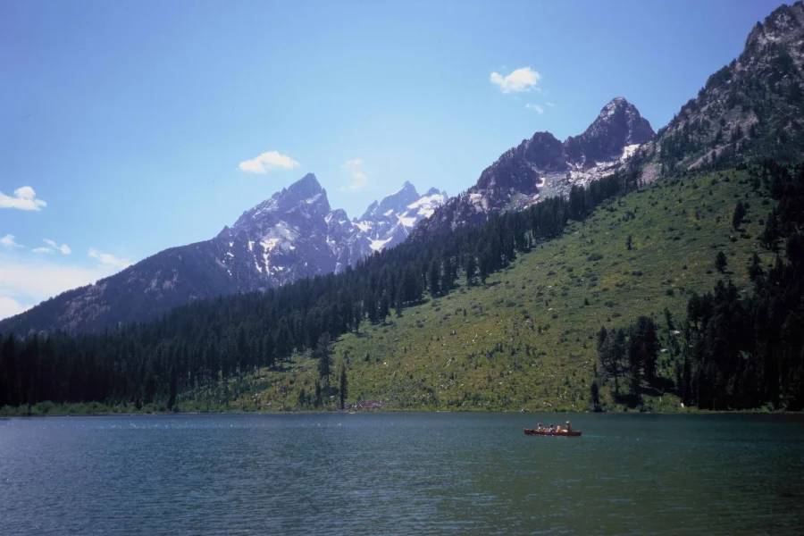
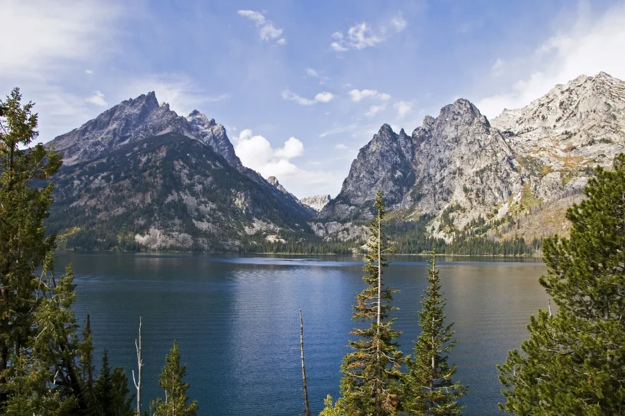
Lakes along the mountain front can appear to be simple mirrors for the peaks. Their shorelines tell a more useful story. Glacial erosion shaped basins; moraines and other deposits influence edges and drainage; forest and exposed rock meet water in patterns that vary from place to place. At Jenny Lake, the mouth of Cascade Canyon creates a strong visual threshold between valley water and mountain interior.
A lake day should be planned as a set of conditions, not a postcard. Shore access, trails, boats, services, parking, weather, wind, water temperature, and seasonal operations can change. A route that looks short on a screen may contain elevation, exposed surfaces, crowded junctions, or a longer return than expected. Check the current official map and operating information, carry what the conditions require, and preserve the option to turn around.
At the shore, notice the relationship between cobble size, vegetation, slope, and wave exposure. Look toward the canyon without treating it as an invitation that must be completed. A threshold can be fully experienced from lower ground. The measure of a day is not the most distant point reached.
5. Understand canyon as a change in scale
Canyons concentrate the transition from valley to high country. Walls narrow the view. Shade and exposure alternate. Water may be close, then hidden. Trail surfaces, snow, ice, rockfall, heat, storms, and congestion can make a familiar route feel different from one visit to the next. Elevation changes the body’s pace even before a traveler reaches alpine terrain.
Good canyon planning begins with a turnaround rule established before fatigue or weather makes the decision. Identify current trail status, route length, elevation, daylight, water availability, and forecast. Know whether a boat or shuttle is part of the plan and whether its operation is current. Do not treat a social-media itinerary as authority. Conditions shown in an old photograph may no longer exist.
In the field, keep looking backward as well as forward. The opening valley may become visible in pieces. Forest composition changes. A stream’s sound reveals gradient even where the channel is obscured. These cues turn a canyon from a corridor to a readable landform.
Still comparing Grand Teton Valley Summit: Fault Braid Field?
Ask for tour ideas, hotel suggestions, or a simple trip plan that combines both.
Trip Helper
6. Treat weather as structure
Mountain weather is not decorative atmosphere. It changes visibility, temperature, wind, lightning exposure, footing, water, and decision time. A clear valley morning does not guarantee a stable afternoon in higher terrain. Clouds can erase a summit while leaving the valley bright; smoke can flatten distance; wind can transform a lake or exposed ridge.
Build flexibility into the plan. Carry layers appropriate to the current forecast and elevation. Keep an alternative that remains valuable if the high route is unsuitable. Consult official weather and park information close to departure rather than relying on a saved forecast. If guidance, closures, or on-the-ground conditions contradict the itinerary, the itinerary changes.
Weather also sharpens observation. Moving shade reveals valley texture. Fresh snow clarifies a ledge or gully. A cloud base provides a temporary elevation reference. These are not reasons to enter unsafe conditions; they are ways to understand the scene while remaining willing to stay low.
7. See habitat before searching for an animal
Grand Teton is home to wildlife, but a wildlife guide should begin with habitat and behavior, not a promised sighting. Sagebrush, wetland, riparian forest, conifer stands, open water, talus, and alpine ground support different needs. Animals move across these zones and across roads. Seasons influence food, cover, migration, nesting, denning, and human-wildlife conflict.
Distance is an ethical and practical discipline. The fact that an animal appears calm does not authorize an approach. Use current park guidance for required distances and area restrictions. Never feed wildlife, block movement, crowd a roadside, or leave a vehicle where stopping is unsafe or prohibited. A long lens and patience are not just photographic choices; they keep the observer from becoming the event.
Practice reading signs that do not require a close encounter: browsing patterns, tracks where lawful to observe, a change in bird calls, an open corridor between cover types, or the relationship between willow and wet ground. The goal is not to convert every clue into a pursuit. It is to understand why space must remain available for movement.
8. Make stewardship visible
Protected landscapes persist through repeated work. Staff and partners monitor conditions, manage waste, repair trails, inspect watercraft, respond to fire and wildlife incidents, restore habitat, maintain visitor facilities, conduct research, interpret history, and communicate changing risks. Visitors participate through ordinary decisions: cleaning and draining watercraft, staying on durable or designated surfaces, packing out waste, following closures, storing food correctly, and giving wildlife room.
This work belongs in the visual story of Grand Teton. A photograph of an aquatic invasive species inspection may feel less iconic than a peak, but it shows a direct relationship between access and care. It also resists the fiction of untouched wilderness managed by nobody. Conservation is social, scientific, administrative, physical, and ongoing.
Before a water-based outing, read current requirements from the park and the relevant state authority. Before a trail day, check alerts and use stations or practices required for food, waste, pets, fire, and invasive species. Do not assume that a practice from another park, another state, or another year applies unchanged here.
9. Replace “empty wilderness” with layered history
The valley was never an empty canvas waiting for scenery tourism. Grand Teton National Park identifies twenty-four associated Tribes with enduring connections to the area. These nations are distinct living sovereign communities. Their histories, present-day governments, languages, cultural practices, and relationships to place should not be compressed into a generic borrowed motif or a single historical paragraph.
A respectful visitor starts with sources. Read material published by the relevant Tribal nation and clearly attributed collaborative interpretation. Pay attention to who is speaking, what period is being described, and whether a statement concerns one nation or has been generalized. Do not copy sacred geography, language, regalia, beadwork, basketry, parfleche, ledger art, petroglyphs, feathers, arrows, or other culturally specific forms into souvenirs, branding, or decorative storytelling.
Later histories also require plural frames. Homesteading, ranching, guiding, conservation, tourism, public administration, labor, road building, science, and community life overlap, sometimes in conflict. Historic structures can open useful questions, but a barn should not stand in for the whole valley. Nor should conservation history erase displacement, contested policy, or the people whose work maintained the landscape visitors now experience.

Scenic Float Trip on the Snake River in Grand Teton National Park
Experience the beauty of Grand Teton National Park with a scenic float trip on the Snake River. This guided tour off...
Private Scenic Snake River Float - Grand Teton Nat'l Park
Discover the natural beauty of Grand Teton National Park on a private scenic float trip along the Snake River. This...
Self-Guided Audio Driving Tour in Grand Teton National Park
Download the GuideAlong self-guided audio tour, and you'll discover more on your Catskill Mountains road trip. Frust...
10. Distinguish Grand Teton from Yellowstone
Grand Teton and Yellowstone are linked in many itineraries, but they are not interchangeable scenery. Substituting geyser imagery, Yellowstone names, or a generic “western park” mood weakens both places. Grand Teton’s field language begins with the abrupt fault-front range, Jackson Hole, braided sections of the Snake River, glacial lakes and moraines, canyon thresholds, sagebrush habitat, and the particular network of communities and public lands around the valley.
This distinction matters in planning too. A map may make two attractions look like neighboring icons while travel time, road conditions, congestion, stops, and seasonal operations produce a different day. Verify current routes and avoid designing an itinerary whose success depends on every transition being faster than expected.
11. Choose a base by the day you want
“Where should I stay?” is better answered with relationships than with a universal ranking. Start with the routes you expect to use, how early you are prepared to move, whether you need to return midday, how much driving fits your trip rhythm, and which services matter. Distances in the valley can feel different under traffic, construction, wildlife slowdowns, weather, or seasonal access.
Separate editorial context from live inventory. A guide can compare the implications of a park-area base, Jackson, Teton Village, or another valley location without inventing room availability, price, or amenities. Provider-owned lodging tools should supply those volatile facts. Confirm the address and cancellation terms at the point of booking, and recheck the current route before arrival.
12. Build one complete day, not seven fragments
A strong Grand Teton day has a primary scale and enough margin to observe. It might pair a valley overlook with a short, condition-appropriate walk and a museum or interpretation stop. It might center a lake threshold and leave the higher canyon for another day. It might follow habitat across the valley without trying to turn every animal report into a chase.
Use a simple field framework:
- Ground: What landform or habitat will organize the day?
- Current facts: Which alerts, forecast, access, or operating details must be verified now?
- Distance: How much driving, walking, elevation, and return time are honestly involved?
- Care: What wildlife, food, waste, water, fire, or surface practices apply?
- Alternative: What lower, shorter, or indoor option remains meaningful if conditions change?
| Decision | Durable context | Verify near departure |
|---|---|---|
| Valley stop | Landform, habitat, legal access, and honest driving distance | Road status, construction, parking rules, weather, and wildlife closures |
| Lake threshold | Shoreline, moraine, forest, water, and the option to remain low | Boat or shuttle operation, trail status, wind, water conditions, and services |
| Canyon day | Elevation, exposure, turnaround margin, and a meaningful lower alternative | Forecast, snow or ice, closures, daylight, water, and current route guidance |
| Wildlife observation | Habitat first, generous distance, lawful stopping, and an unforced encounter | Required distances, temporary area restrictions, road conditions, and staff direction |
Turn the comparison into a short decision tree rather than a rigid checklist:
- Name the primary scale.
- Choose valley, lake, canyon, or high country as the day’s organizing field.
- Keep one lower, shorter, or indoor alternative that is worthwhile on its own.
- Locate the live decision.
- Check the responsible authority for the specific road, trail, water, weather, wildlife, or service question.
- Recheck when departure is close enough for conditions to matter.
This framework does not make the landscape predictable. It makes the traveler more responsive. The mountains can remain partly obscured, the animal can remain unseen, and the day can still be complete.
13. Use primary sources at the decision point
For current park alerts, conditions, maps, rules, safety, history, and planning context, begin with Grand Teton National Park. For weather affecting the specific place and elevation you intend to visit, use the National Weather Service. For wildfire and smoke information, consult the responsible official incident and air-quality sources named in current public guidance. For state watercraft and wildlife rules, use the relevant Wyoming authority. For Tribal history and present-day information, prefer the government or cultural institution of the specific nation being discussed.
Primary sources do not remove judgment. They establish responsibility and date. Record when you checked a volatile fact, keep the source link, and check again when the decision becomes immediate.
The range rises from a deeper field
Grand Teton’s skyline deserves attention, but it should not consume everything beneath it. The fault explains an abrupt front; glacial deposits and water explain thresholds and lower ground; habitat explains distance; weather explains flexibility; stewardship explains continued access; layered histories explain why the valley cannot be called empty.
Self-Guided Audio Driving Tour in Grand Teton National Park
Download the GuideAlong self-guided audio tour, and you'll discover more on your Catskill Mountains road trip. Frust...
Scenic Float Trip on the Snake River in Grand Teton National Park
Experience the beauty of Grand Teton National Park with a scenic float trip on the Snake River. This guided tour off...
Grand Teton National Park Tour from Jackson Hole
Experience the tranquil landscapes of Grand Teton National Park on this easy day trip from Jackson. A must-see Wyomi...

Grand Teton Half Day Tour
Grand Teton National Park in Jackson Hole Wyoming is a must see, truly a magnificent wilderness area. This professionally guided, small-group four h...

Grand Teton National Park - Full-Day Guided Tour from Jackson Hole
Enjoy 8-9 hours exploring Grand Teton National Park visiting some of its top attractions: see Jackson and Jenny lake...

Yellowstone Lower Loop Full-Day Tour
Yellowstone National Park, Old Faithful, Lake Yellowstone and more! This is a tour of the Lower Loop of Yellowston...
Yellowstone National Park - Full-Day Lower Loop Tour from Jackson
Explore Yellowstone on a 12-13 hour tour with a local guide. Set out FROM JACKSON HOLE, WY area to experience Americ...
Stand where it is safe and lawful. Let the eye move from river braid to sage, from moraine to forest, from canyon to summit. Then let it return. The second movement—back down into the field—is where a famous view becomes a place.